City Transit App
A dashboard and companion app that was submitted as a bid for a grant to help people move around the city of Cincinnati
See case study
My role
I designed the dashboard and companion app concept, owning the UX and UI for the mobile-first screens.
Services

The problem
Getting around Cincinnati means piecing together routes from separate transit options with no single view of what's available. The grant called for a way to use open data to make the city easier to move through.
Solution
city transit dashboard
See all available transit options to a destination within the city on this companion dashboard app.

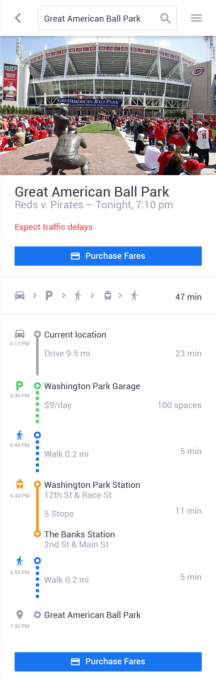
route suggestion
Use open data sources to find the optimal route to a destination to minimize travel time and ease city congestion.
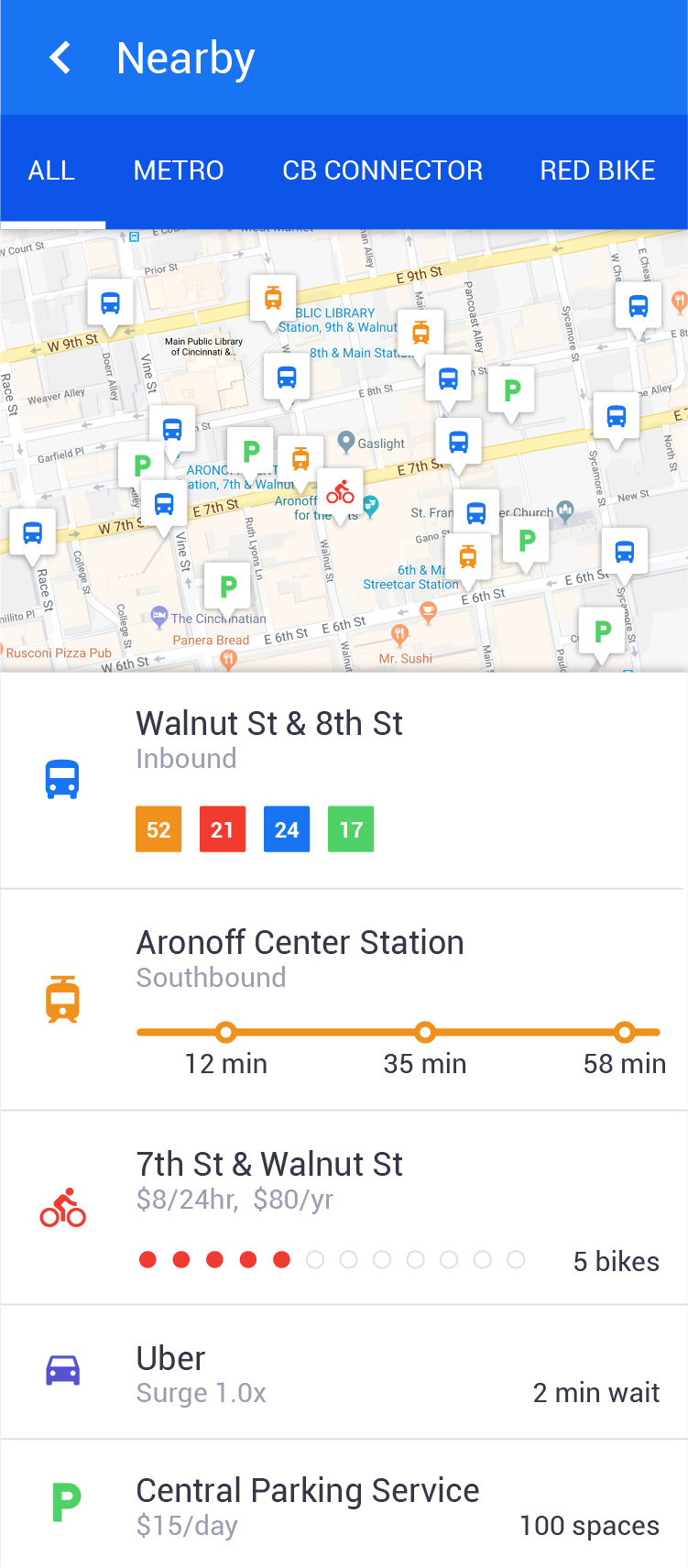
nearby transit options
Easily explore all the transit options near you using the map or list view.
bus stop
See all the available service lines and pre-purchase fares.

stop schedule
Scroll down after selecting a transit option to view the arrival schedule.

Outcome
The dashboard and companion app went out as a bid for the city grant, using open data sources to suggest routes and surface nearby transit options.
About the client
Using the power of open data to create a more accessible city


